A little known wonder deep in the Shaker woods.
By Beth Friedman-Romell

Most Shaker residents are familiar with the lakes and trails flanking the meandering course of Doan Brook around the Shaker Lakes. But fewer of us have explored the brook west of Coventry Road. The trails surrounding the Doan Brook down to University Circle offer tranquility and ever-changing landscape mere feet from roaring traffic. This is the gorge.
I first encountered the area a decade ago, on a hike sponsored by the Nature Center. Alas, a bee promptly stung Elder Son, and I failed to return for many years. Happily, Younger Son likes to climb rocks and ford streams, so I convinced him that exploring this trail close to home was worth a try.
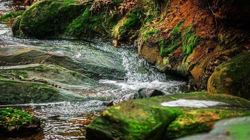
Y.S. led me off trail, resulting in some scrapes and bruises, and the discovery of the “graffiti rock” and charming waterfall, which is my favorite place to come when I need to calm my ragged thoughts. When the water is low, you can walk upstream, or climb up and down the waterfall.
As we followed the brook downstream, many questions arose. Who laid out the now-crumbling stone steps and path linings? What formed those mysterious craters? For what purpose are those cement pilings, with their protruding steel girders? Why are parts of the banks composed of craggy rocks and others of dirt? Who left that bra in the woods, those shorts in the stream?
Formed by a glacier, the Doan Brook is a mere 14,000 years old, but different layers of rock are much older – about 350 million years, a time when Ohio was under a sea and much farther south.
Most of my questions have been answered on a recent series of seasonal hikes, sponsored by the Doan Brook Watershed Partnership and led by Dr. Roy Larick, an expert on the natural and cultural history of Bluestone Heights, a massive geological formation upon which much of the East Side is built. On the spring hike, which focused on the natural history of the gorge, we learned that Doan Brook, formed by a glacier, is a mere 14,000 years old, but different layers of rock are much older – about 350 million years, a time when Ohio was under a sea and much farther south.
Our summer hike focused on early human transformations of the terrain. It is likely that Native Americans used the woods around the brook as transitory campgrounds. In the early 19th century, the North Union Shakers cleared the forest and dammed the brook to power several mills. Small segments of the original dam and foundation can still be seen in an overgrown site adjacent to Coventry Road at the base of Lower Lake.
The lower brook is a wooded haven these days, but in the 19th century, it was a busy industrial site. Those “craters” were once small quarries, when railroad trestles spanned the ravine. On our fall hike, we learned about the “suburbanization” of the gorge.
Beginning in the 1880s, wealthy industrialists donated land along the brook to transform and preserve it as a public park. Stone steps and carriage trails invited thousands of visitors from the crowded cities. Traces of this infrastructure still remain, poking up through dirt and tree roots. (Those trees, by the way, took hold in the fill that was dumped in the gorge when the Baldwin Reservoir was constructed in 1925.)
On this hike, we were treated to a spectacular view of the gorge from the terrace of a home at Fairhill Village. We also learned that the concrete “trash rack” just east of Martin Luther King Drive is a 1970s effort at flood control, which is slated for removal. And I finally found the path to the gorge west of MLK, aka Ambler Park. Beyond the concrete “detention pond” are more wooded trails, which open onto a grassy area at the bottom of the hill.
Congratulations – you are now standing at the western limit of the Allegheny Mountains! While humans have been altering the brook for a couple of centuries, Nature can transform it in an instant. On July 27, 2014, I took my friend Robin on the trail under a slight drizzle. She was anxious, but I urged her to press on. When the trails became streams, I figured we should climb out and head home up Fairhill. I left her in the safety of an apartment vestibule and headed for the car, parked at Lower Lake. Then I heard voices coming from the waterfall. I ducked back down the trail to discover a roaring torrent. The brook had become a river, fast exceeding its banks. Three guys cheerfully waved to me from the rock ledge across the way. Soon after, Coventry and Fairhill were flooded.
I feel a deep connection to this little urban stream in all its moods. I encourage you to check out its trails, and support the efforts of all those trying to restore and protect it.


